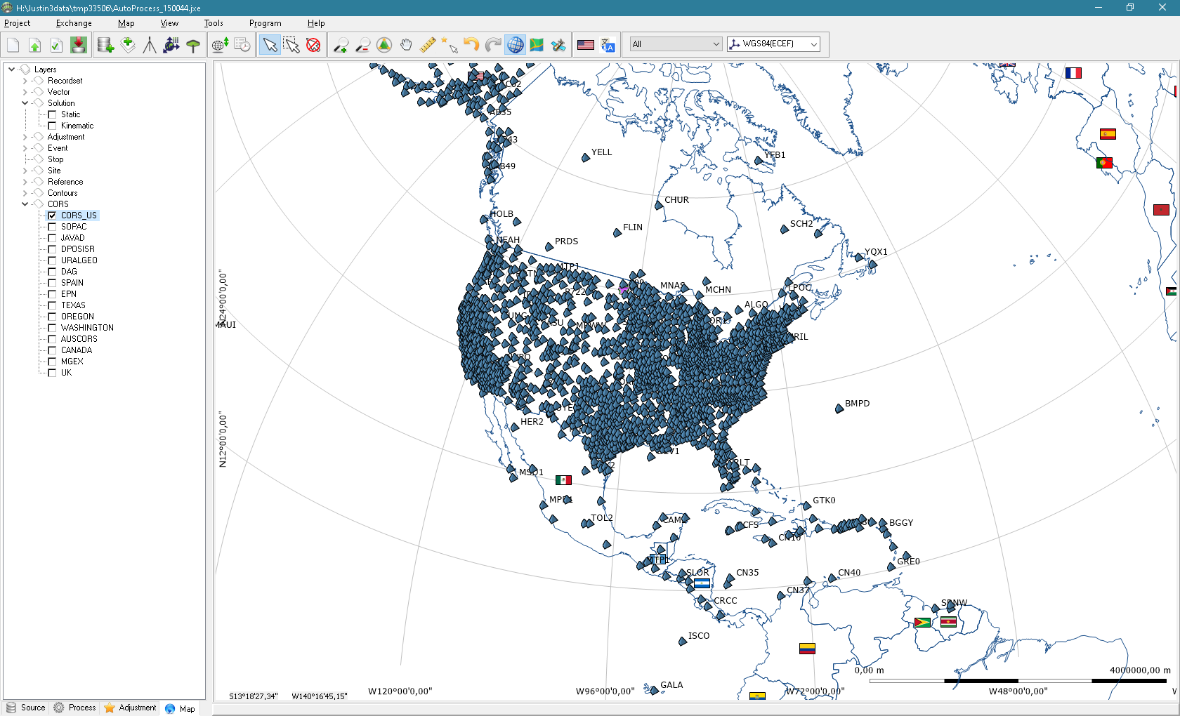
Justin 3 is an enhanced version of well proven Justin software. As a predecessor it is full featured professional tool for surveying, geodesy,
aerial photography. GIS style interface makes effortless post processing of GNSS data and project management.
The software discloses all advantages of JAVAD technology products and has been optimized to deal the highest precision with least amount of operator invention.
It is the only desktop software version of DPOS (Data Post processing Online Service) of JAVAD company.
Main new features
- unlimited project size;
- post processing GPS, GLONASS, Galileo, Beidou, QZSS;
- precise point positioning (PPP);
- multi thread data processing;
- cartography on the globe;
- console version.
Features
Post-processing
- static, kinematic, stop@go modes;
- multiple signals;
- interactive mode with time line (static) and vertical profile (kinematic) epoch capturing;
- PPP;
- online access to Internet GNSS data source.
Adjustment
- rigorous mathematical model - full covariance matrixes for solutions and reference points;
- internal and external constraints;
- XYZ and NEU mode of blunder detection;
- up to 3000 sites network.
Localization
- export/import with template;
- 2D/3D mode;
- automatic and interactive blunder detection with chart;
GIS
- cartography on the globe;
- online background maps;
- multiple coordinate systems (>2000);
- map features – layers, selection objects on map, table, charts in parallel, object styles and types and labelling;
- vector and raster customer background maps;
- group data management.
Export/Import
- multi base and multi antenna jps files;
- import GNSS data - RINEX 2.11-3.04, Hatanaka compressed, RTCM 3.0, precise ephemeris, NGS atx, P1C1 biases, satellite clock;
- export raw data to RINEX and jps files;
- export to csv, shape, MID/MIF and tab, kml, PNEZD, StarNet, xml, DXF, txt.
Aerial photography
- import Ashtech.dat, Leica.ev event files, text template;
- event processing;
- camera database management.
Raw data tool
- thinning, picking, merging, splitting GNSS data;
- GNSS systems, satellites, signals operability;
- chart and table view;
- trajectories and vertical profile.

